Management
Naše projekty pro Smart city
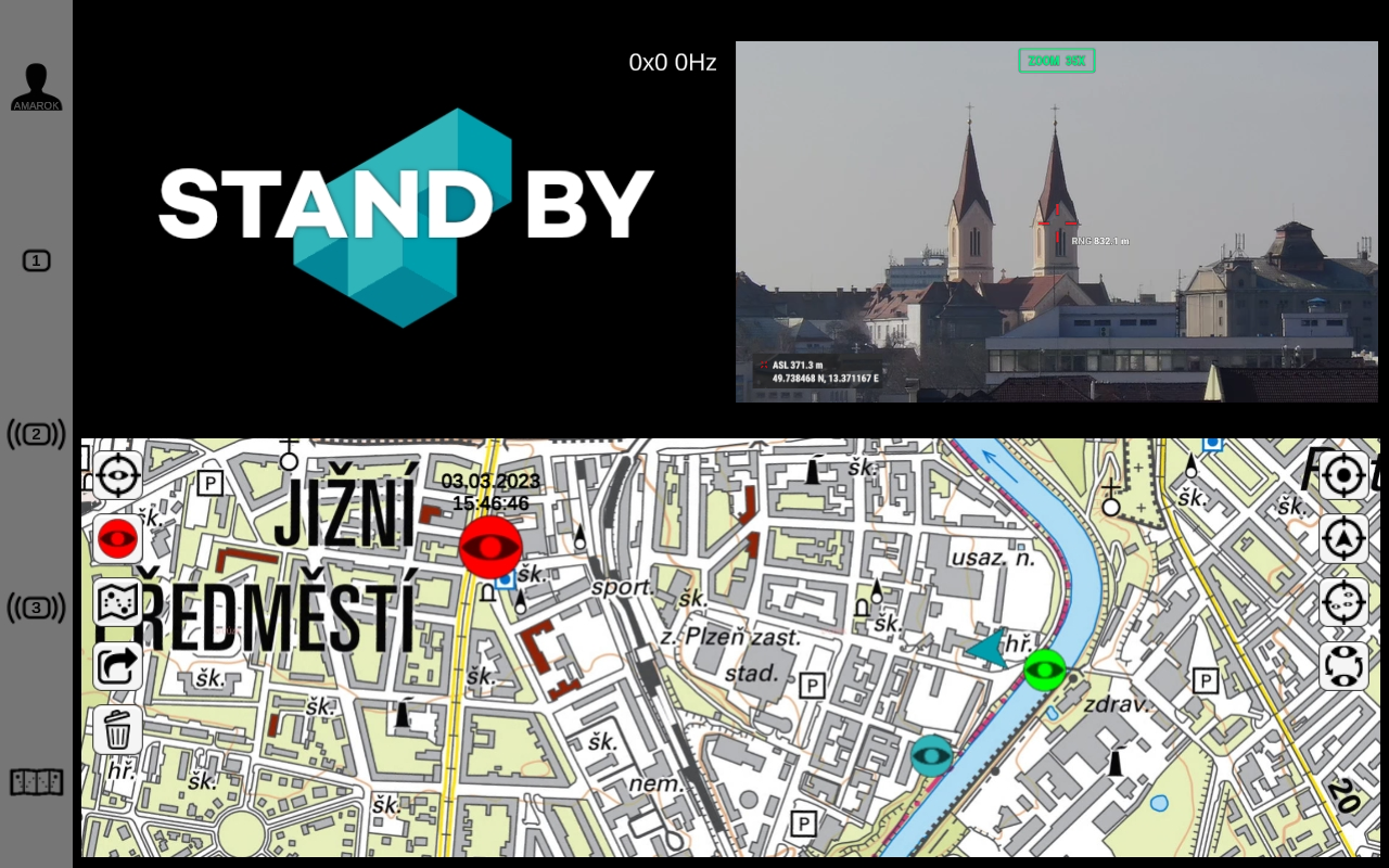
IZS Stream as the Most Important Support for IRS
One of the highly used applications that our team from Drones SIT has developed in 2020 is IZS Stream. The software has found use with the integrated rescue system - especially firefighters and police officers.
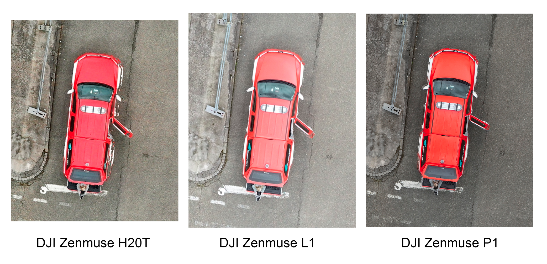
DJI Zenmuse Camera Comparison
The team Drones SIT launched an interesting comparison. In their work within the framework of interventions with the IRS forces, our colleagues most often use the DJI Matrice 300 RTK drone, but they add various equipment to it in the form of cameras or searchlights. And it was the comparison of cameras that our team focused on.
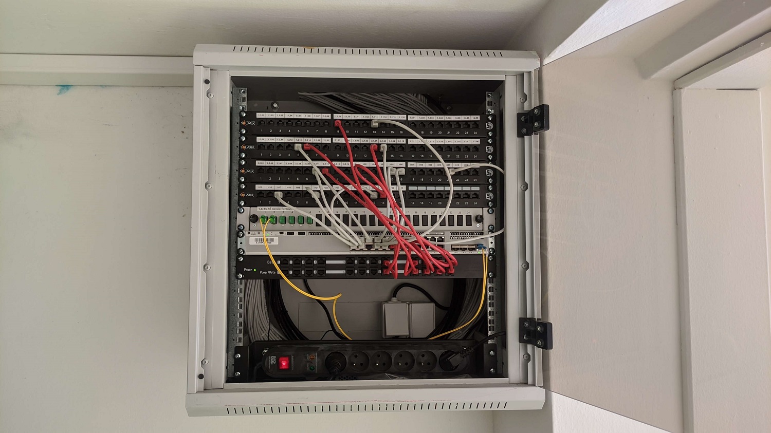
Reconstruction of LAN Networks in Schools
We provide extensive services to the city's kindergartens and primary schools. We equip them with the appropriate technology and software licences, respond to their needs and modernise their computer networks. LAN data networks, in particular, have undergone significant reconstruction in recent years.
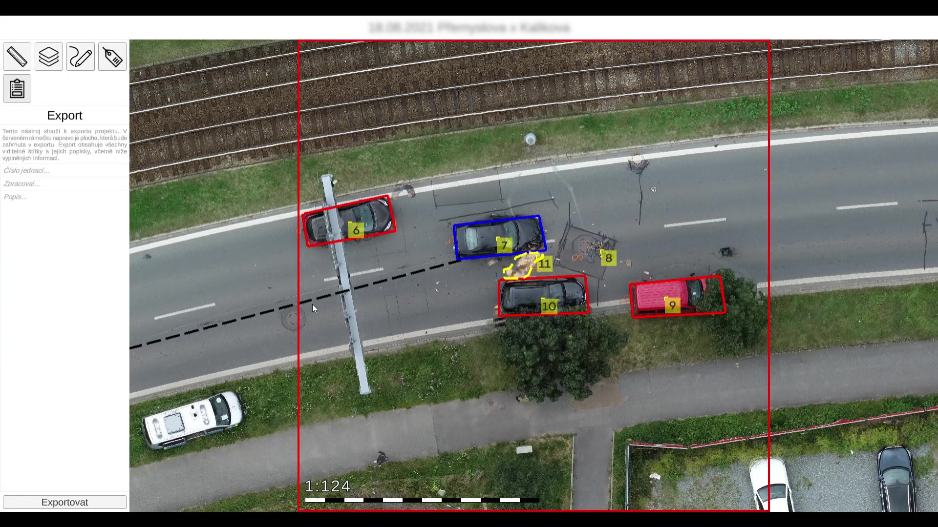
Crash Inspector – App for Traffic Police
For police use, Drones SIT take images from the scene of a serious traffic accident. Because the event needs to be recorded and the data further processed, the Crash Inspector App was created.
New Pilsen Geoportal
At the end of January 2024, we started a project to renew the Geographic Information System (GIS) of the City of Pilsen. Over the next 16 months, we will be transferring maps and map applications to the new geoportal.
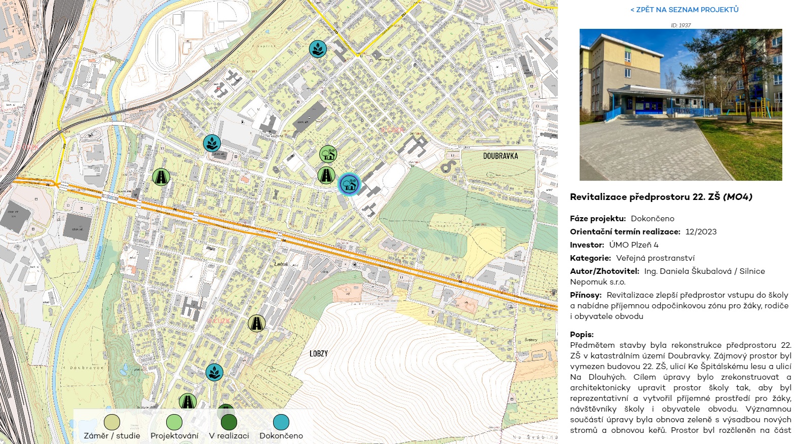
Interactive Map of Investment Projects
We have launched a map of investment actions linked to the Superdio Traffic Engineering. It shows citizens new, ongoing and completed city capital projects in their district.