IZS Stream as the Most Important Support for IRS

One of the most widely used applications developed by the Drones SIT team in 2020 is IZS Stream. The software was immediately used by the Integrated Rescue System (IRS) – especially by firefighters and police officers. Its use in practice then revealed place for continuous improvement, and in May 2023 a major update of the application came in the form of a new feature. How does the smart system work?
It is not just the drone with camera or other ground cameras that is important, but also the Teradek technology built into the handy backpack matters. This can stream the image as distributed video to a server and from there to the app of each participant in the intervention, if granted access. Everything is secure. The image arrives where it is needed with a short delay of about one second.
The stream can be viewed on tablets, mobile devices or a computer. The IRS can even send simple commands to each other via our app.
The app is secure – the user has a login and password, without which they cannot access the system. Drones SIT act as an administrator, assigning specific video streams to individual users.
Streams can also be split, for example for parallel hits (each unit sees only its own hit) or vice versa (videos can be merged when a common hit is made). In total, up to three videos can be combined (one from the drone and two from the ground camera).
The latest feature of the software can display suspicious points. This could be a fire outbreak or a missing person.
Aims of the project:
- To create a complete and secure solution for streaming data from the scene of a crisis event.
- To mark points of interest and determine the exact location of the monitored target (fire outbreaks, wanted persons, etc.).
Results of the project:
- The creation of a solution consisting of a cross-platform application that facilitates and secures the distribution of data for the IRS units (firefighters and police).
- Streamed secure transmission with a delay of one second.
What kind of drones and cameras do Drones SIT use for IZS Stream? We use DJI Matrice 300 drones with H20T camera or DJI Matrice 30T drones with integrated camera. The drone pilots are able to calculate the GPS coordinates of the area the drone is currently targeting. They can do this thanks to the sensor on these cameras. It is also possible to calculate the distance and GPS coordinates at a distance of approximately 1,200 metres.
More information is available at the Drones SIT website.
Další projekty
Pilsen – Satellite Image Analysis

Electronic Citizen’s Portal
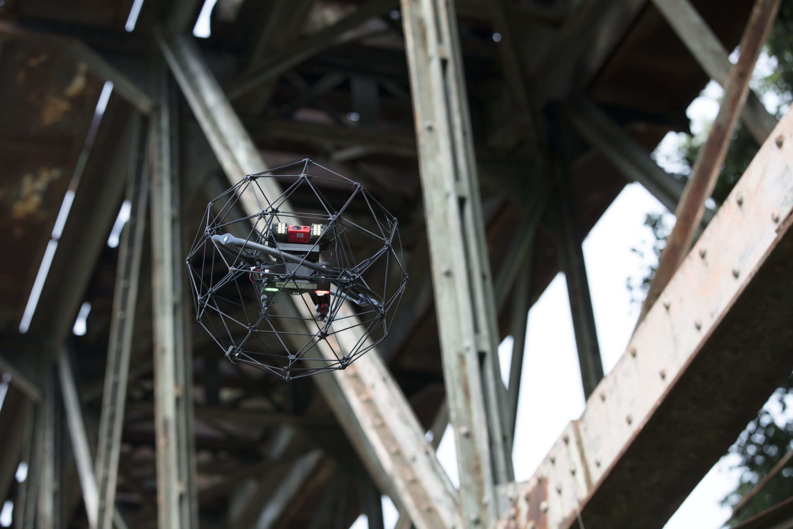
Using Drones to Inspect Bridges