Crash Inspector – App for Traffic Police
Since 2021, our department Drones SIT has been working closely with the traffic police in the Pilsen Region. Our team goes to the most serious traffic accidents together with other parts of the Integrated Rescue System. For the needs of the police, the drones are used to document and to take pictures of the scene of a traffic accident. In order to record the documents and process the data, the team of Drones SIT developed the Crash Inspector application.
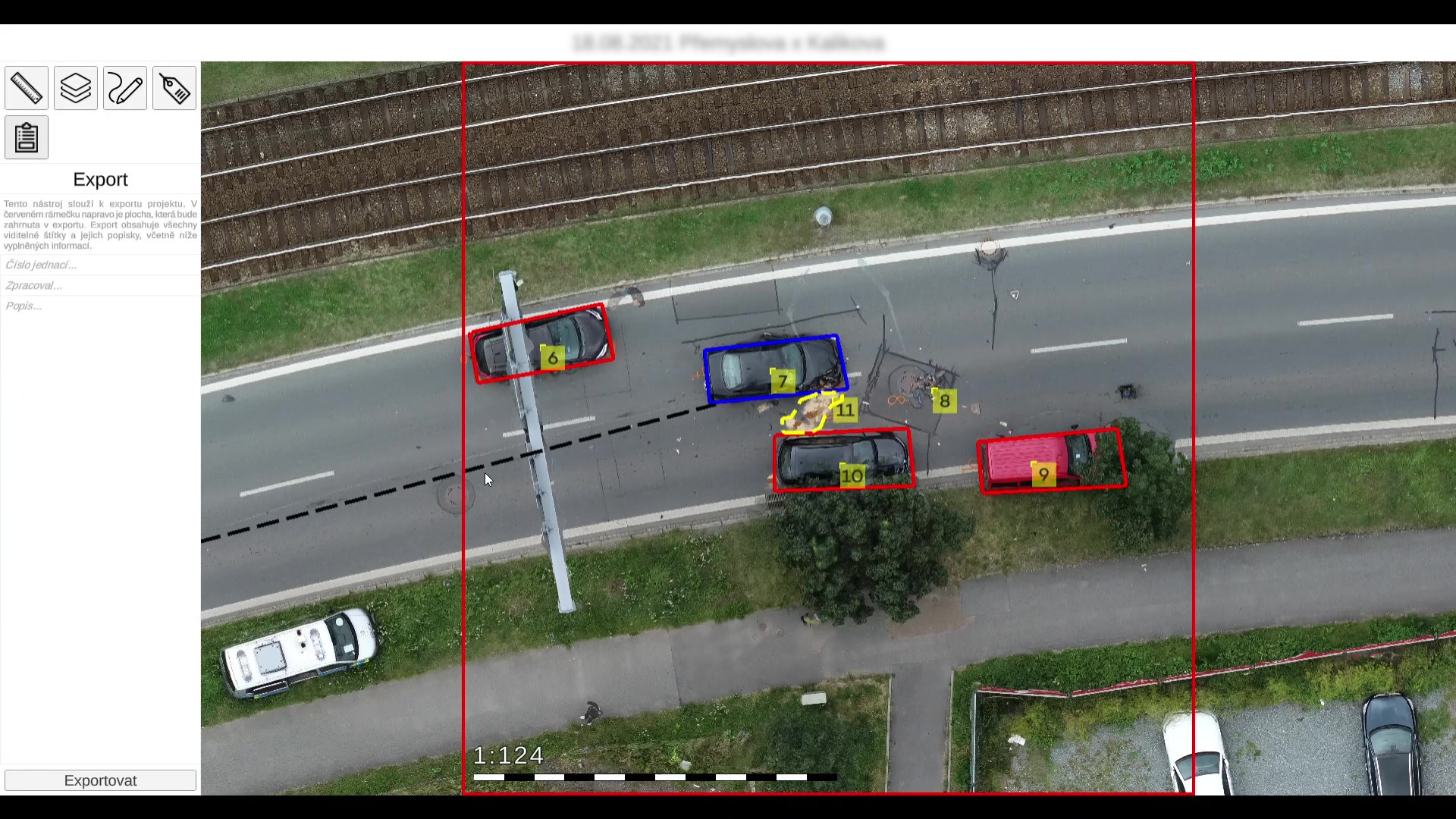
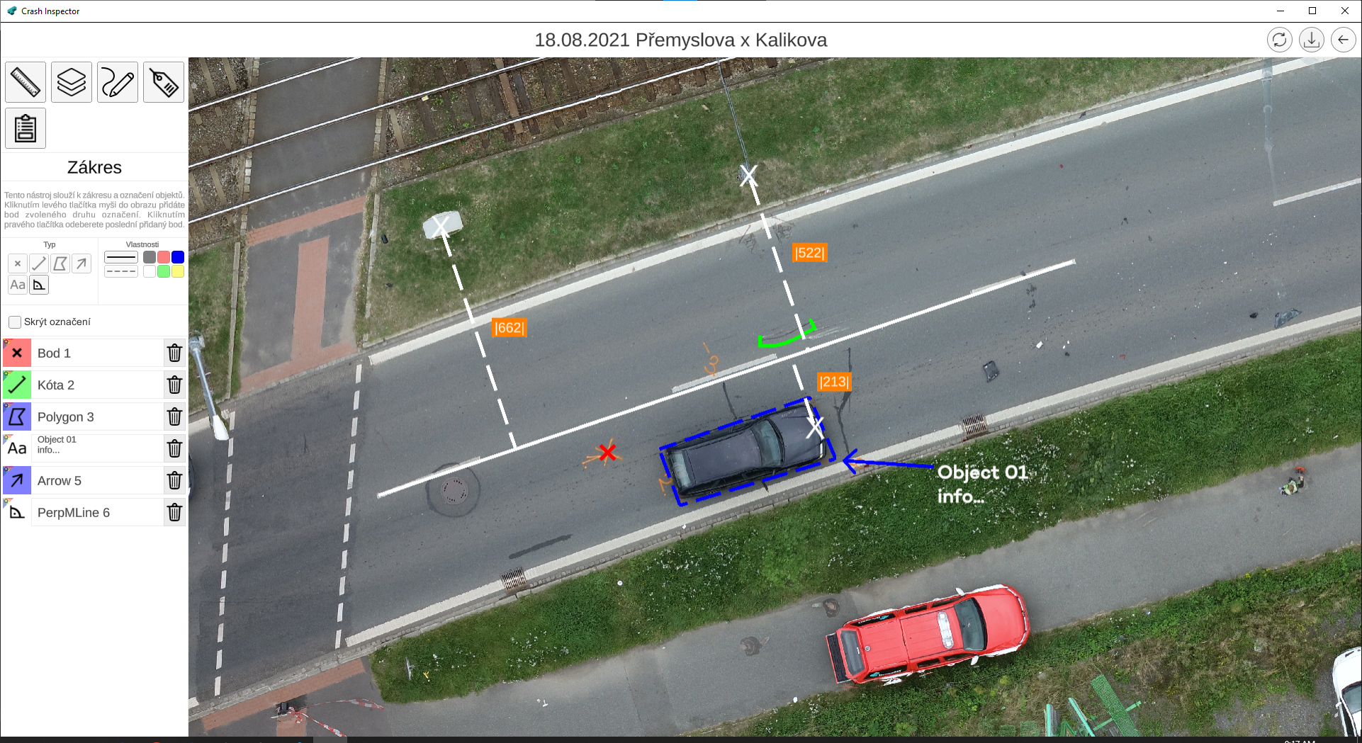
Crash Inspector is able to display even very demanding data relatively quickly and easily, without loss of quality and with accuracy to the nearest centimetre. Each point or pixel has unique GPS coordinates, providing an accurate record of the accident scene, not only for police officers, but also for forensic experts and other parties involved. In these records, officers can measure distance, enter dimensions, describe and mark locations or tracks. The application can generate an accident report in the form and format required by the police.
Aims of the project:
- To provide assistance to the police when responding to serious traffic accidents.
- To create a record documenting the accident.
- To simplify the recording and handling options.
Results of the project:
- Development of a smart app called Crash Inspector.
- Creation of an accurate record of the crash and its use as an evidence,
- Further development of the app.
To make their work more efficient, the officers’ feedback showed how the application could be further improved. That’s why GIS layers were added and are used to display following:
- Traffic Signs – shows the exact location of the traffic sign, making it easier to determine who is at fault in an accident.
- Road markings – facilitates communication between the emergency services, allowing a specific road to be named immediately.
In 2023, Crash Inspector was further enhanced with a point layer with precise targeting. These are fixed outdoor points, such as corners of buildings or electricity poles, that serve as a place of departure for measurements. Drones SIT has developed its own mobile app to show these points in the area of an accident.
Obviously, Crash Inspector includes a tool for drawing and editing in the footage (different kinds of highlighting, fonts, bullets, etc.). Police officers can mark tracks, braking paths and other necessary information to the image. All this is used to describe the event in more detail. The Crash Inspector report is provided with a scale for the area and with the signature of the person who created it. This also facilitates follow-up communication between those involved in the investigation.
More information about the Crash Inspector App is available at the SIT Drones website.
Další projekty
Parking Fee Monitoring Smart Vehicle
Eduroam

Electronic Citizen’s Portal