Pilsen – Satellite Image Analysis
In cooperation with the company World from Space s.r.o. we carried out an analysis of satellite data of the city of Pilsen. It was a pilot project in which we wanted to check which data we could obtain and what their significance would be. The results of the analysis are very interesting.

Aims of the project:
- the effect of industrial zones on temperature rise,
- the effect of water, green areas, forests on reducing it,
- the “reduction in the volume” of greenery in the summer months – where there is no irrigation,
- change in agricultural areas (humidity, temperature reduction until before harvest, development after harvest),
- proportion of buildings, green areas, water bodies, etc..
The project has also been updated with data/analysis for the period 2015-2018 (download – Drought Study 2015-18, map documents + open data). The data is regularly updated and we have created an interactive presentation for the web.
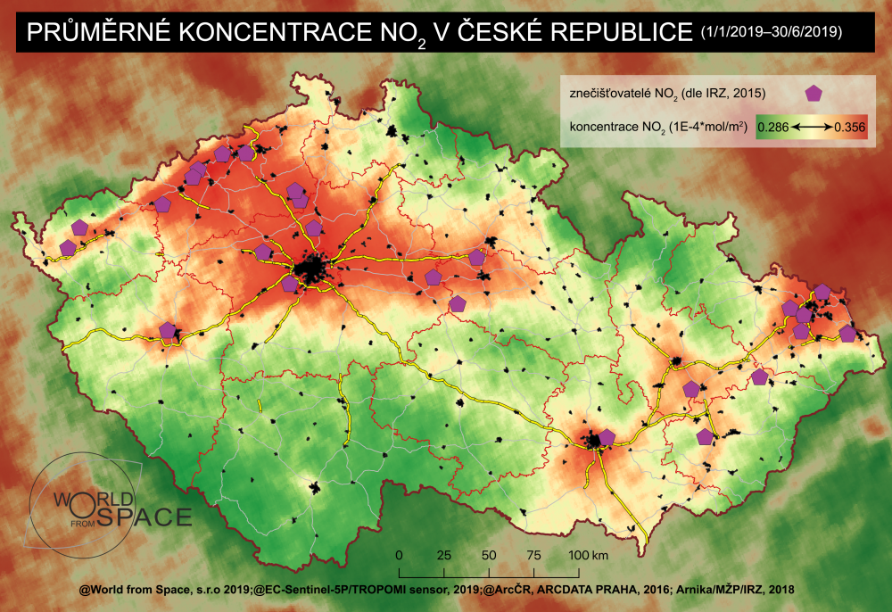
In the next part, we will continue with the satellite analysis of Pilsen’s air. More information can be found on the project card Satellite analysis of Pilsen’s air.
Other projects
Satellite analysis of Pilsen Air II.
Child safety – Measures in Primary Schools
Drone for Fire and Rescue Service