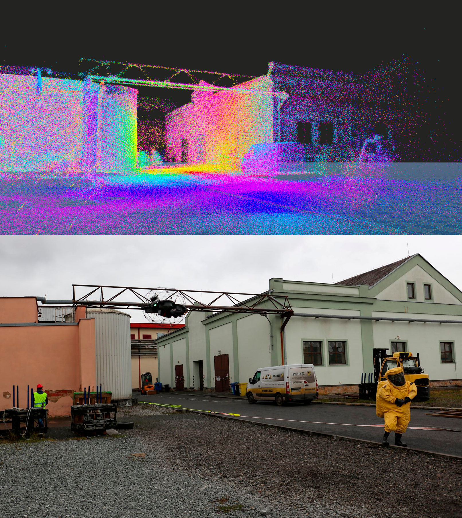
3D Model Viewer – New Application for IRS
We have added a new application to the list of developed applications, which is the result of the work of our colleagues at Drones SIT. It is a viewer of 3D models – so-called point clouds – developed for the Integrated Rescue System (IRS) by our drone pilots and operators, who are also an official part of the IRS. This cooperation is unique in the Czech Republic. The drones are often used to scan buildings and objects before the emergency services enter them. If the project documentation is not available, the drones can even show details in the form of closed doors, windows, and other obstacles.
Aims of the project:
- To create an application for the IZS that provides a 3D view of the scanned object on a standard computer.
- To display 3D view to the commander right away and in real time.
- Not only to provide the output from the intervention in 2D (photo, video), but to be able to work with the captured data in 3D.
Results of the project:
- A new Point Cloud Reader application that uses a LIDAR scanner to put together a virtual 3D image of the scanned area.
- Attaching a laser scanner to a rotating device (drone) that, thanks to LIDAR technology, measures the distance based on the reflection time of the laser beam from the object being scanned.
- The measurements can result in thousands to tens of millions of points, which the new application arranges and displays in a 3D model.
However, the creation of the app does not mean the end of the work. Our Drones SIT team is already working on improvements. They are going to add a feature that will be able to show the points in the acquired model where, for example, the searched persons are located, thus possibly facilitating search and rescue missions.
You can read an article about what drones are used in the interventions or how the whole technology works directly on the Drones SIT website.
Other projects
Digi-Nursery School
Pilsen as a member of the Horizon Europe Project CLIMABOROUGH
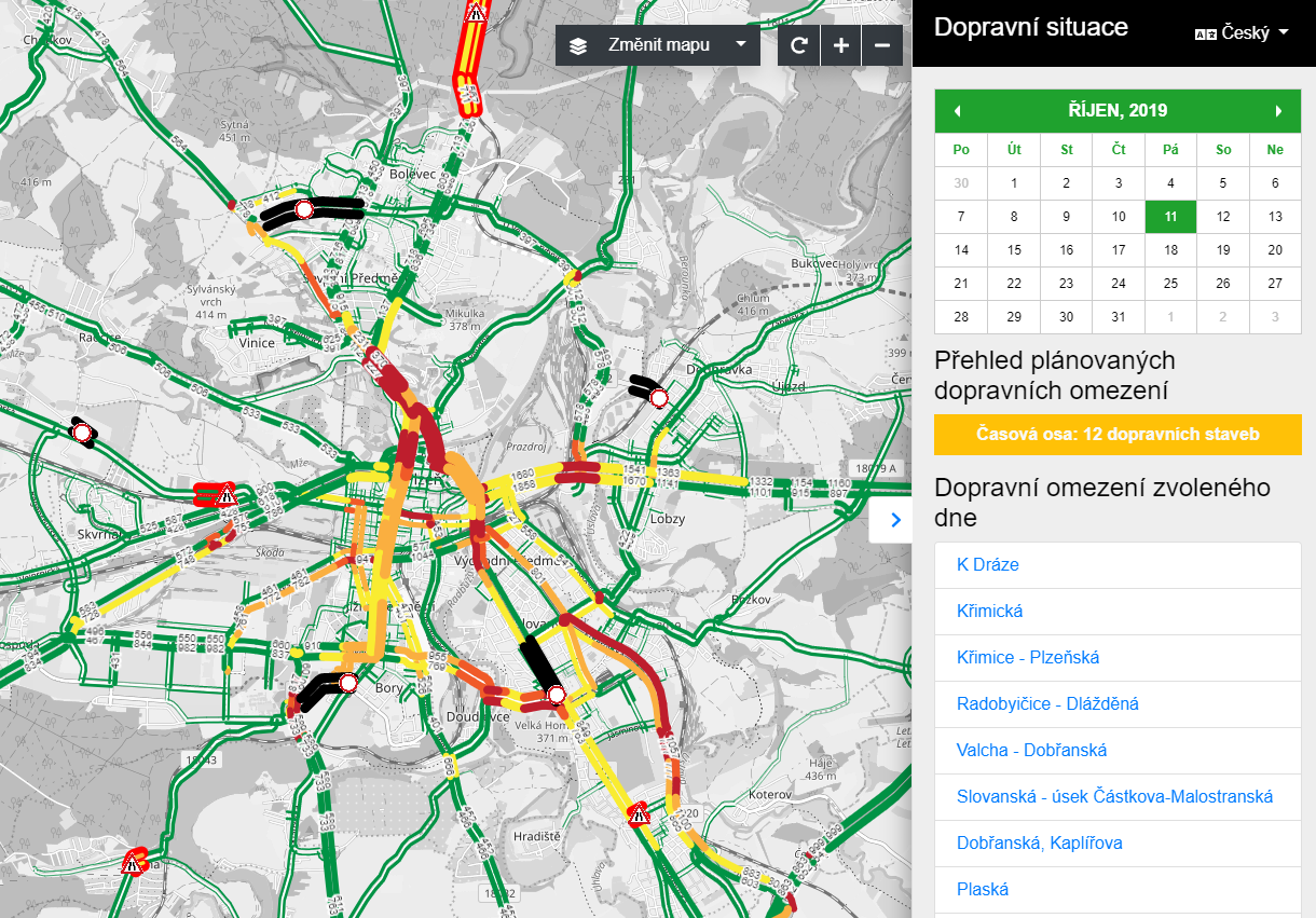
Traffic Intensity Visualization – a HORIZON 2020 Project